High Street from Mardale Head via Rough Crag
High Street's finest side: up the long ridge of Rough Crag and Long Stile above Haweswater, then down by Mardale Ill Bell, Nan Bield Pass and Small Water.
- Distance
- 9.6 km
- 6.0 miles
- Ascent
- 632 m
- High point 828 m
- Time
- 3 hours
- Walking time, no stops
- Grade
- Hard
- Circular
Take this walk with you
Google Maps does not know most fell paths, so use it to get to the start, then follow the GPX in an app like OS Maps, Komoot or AllTrails. To see the line in Google Maps, open Google My Maps, create a map, choose Import and pick the KML file. It then appears in the Google Maps app under Saved, Maps.
Weather on this walk
Loading the forecast
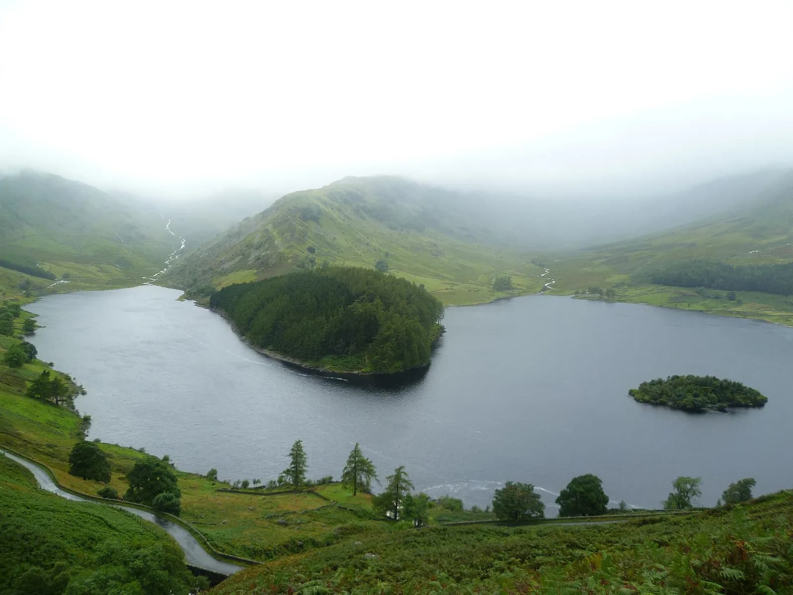
From Patterdale High Street can seem like a grassy lump. From Mardale Head it is a different mountain: slender ridges, deep corrie tarns and crags on every side. This round climbs the spine between Riggindale and the hollow of Blea Water, the deepest tarn in the Lake District.
The ridge of Rough Crag rises in a long, satisfying line from the end of Haweswater, beside an old wall at first, to a cairned top. A boggy dip at Caspel Gate leads to Long Stile, the steepest part of the day, which tops out on the broad summit plateau where the Roman road once ran. The descent swings over Mardale Ill Bell to the stone shelter on Nan Bield Pass and down past Small Water.
It is a quiet corner, well away from the busiest fells, and a superb half day for walkers who like a bit of rock underfoot without real scrambling.
The route
- 1
Mardale Head to the ridge
From the end of the road walk through the gate at the far end of the car park, then turn right on the path signed for Bampton, crossing the footbridge over Mardale Beck. Follow the path along the shore and pick up one of the paths climbing onto the crest of the ridge.
- 2
Up Rough Crag
Follow the wall up the ridge. The path is mostly grassy with a few rocky steps and favours the Mardale side, with views back along Haweswater, until it reaches the cairn on Rough Crag.
- 3
Caspel Gate and Long Stile
Drop into the boggy dip of Caspel Gate, with Blea Water below on your left, and climb Long Stile. It is steep and rocky but still a walk. The path emerges on the grassy plateau; the trig point is a short way south-west.
- 4
Over Mardale Ill Bell
Head south across the plateau and bear left onto the path to Mardale Ill Bell, with views down into both Kentmere and Mardale.
- 5
Nan Bield Pass and Small Water
Descend steeply to the stone shelter on Nan Bield Pass, then turn left and follow the old pass path down past Small Water and back to Mardale Head.
Questions people ask
Where do you park for High Street from Haweswater?
At Mardale Head car park, at the far end of the road along Haweswater. Mud and Routes says it is free and holds about 30 cars.
Is Rough Crag exposed?
Not really. Mud and Routes describes the ridge as quite broad and never knife-edged, with only short, easy rocky steps.
How long is the High Street walk from Mardale Head?
Mud and Routes gives 4.15 km for the climb by Rough Crag and Long Stile and 4.8 km for the Nan Bield route, so this round is roughly 9 km.
Why is it called High Street?
It is named after the Roman road that ran over the summit, according to Wikipedia.
More walks nearby
The Kentmere Horseshoe
Hard, 21.2 km, 1157 m up, about 6 hours
A long, classic round of nine Wainwrights from Kentmere: up the Garburn Road to Yoke and Ill Bell, over High Street, and home by Harter Fell and Shipman Knotts.
Place Fell from Patterdale
Moderate, 7.6 km, 542 m up, about 2 hours 30 minutes
The best viewpoint over Ullswater for the effort: up from Patterdale to Boredale Hause and Place Fell, then down by The Knight to the lakeshore path.
Hallin Fell and the Ullswater shore from Martindale
Moderate, 5.0 km, 266 m up, about 1 hour 30 minutes
Ullswater's best small fell: a 20-minute pull to a huge summit cairn, then a loop round the wooded shore past Kailpot Crag.