Helvellyn via Striding Edge and Swirral Edge
England's most famous ridge scramble: from Glenridding over the knife edge of Striding Edge to Helvellyn, then down Swirral Edge past Red Tarn.
- Distance
- 13.3 km
- 8.3 miles
- Ascent
- 955 m
- High point 947 m
- Time
- 4 hours 30 minutes
- Walking time, no stops
- Grade
- Mountain
- Circular
Take this walk with you
Google Maps does not know most fell paths, so use it to get to the start, then follow the GPX in an app like OS Maps, Komoot or AllTrails. To see the line in Google Maps, open Google My Maps, create a map, choose Import and pick the KML file. It then appears in the Google Maps app under Saved, Maps.
Weather on this walk
Loading the forecast
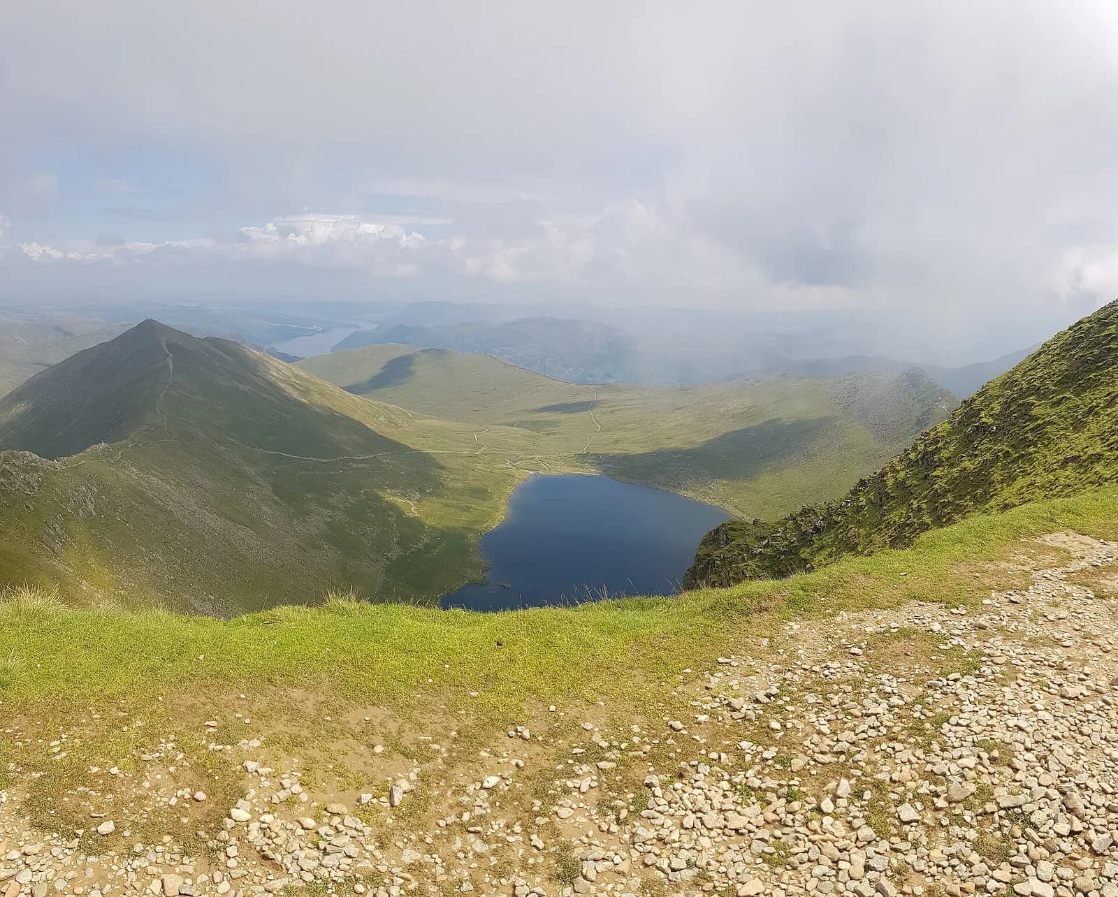
Striding Edge is the reason many people fall for the fells. A narrow crest of rock runs out from the Hole-in-the-Wall towards Helvellyn, with steep drops into Red Tarn on one side and Nethermost Cove on the other, and the summit plateau waiting at the far end.
This is the classic horseshoe from Glenridding: up past Lanty's Tarn to the Hole-in-the-Wall, along Striding Edge, over the summit, and down Swirral Edge to Red Tarn before the long walk out. It is a serious mountain day. In good, dry conditions and with a head for heights it is unforgettable; in wind, wet or winter it is a different proposition altogether.
The route
- 1
Glenridding to Lanty's Tarn
From the car park walk up through the village and take the path climbing south-west to Lanty's Tarn, a small tree-fringed tarn on the shoulder above the valley.
- 2
Up to the Hole-in-the-Wall
Continue up the long, steady path along the flank of Birkhouse Moor to the wall crossing known as the Hole-in-the-Wall. Striding Edge comes into view ahead.
- 3
Striding Edge
Follow the ridge as it narrows. You can stay on the crest for the full scramble or use the paths a little below it on the right for much of the way. The awkward bit is a short rocky down-climb near the far end, before the final climb.
- 4
The summit plateau
A steep rocky scramble up loose ground brings you onto the broad summit plateau. Walk across to the summit shelter, keeping well back from the cornice edge in winter.
- 5
Down Swirral Edge
From just north of the summit find the top of Swirral Edge, marked by a cairn, and descend the rocky crest with care. It is shorter and slightly easier than Striding Edge but still needs hands.
- 6
Red Tarn and back
At the foot of the edge drop to Red Tarn, then follow the path east back to the Hole-in-the-Wall and down the main path on the north-east side of Birkhouse Moor into Glenridding.
Questions people ask
How dangerous is Striding Edge?
It is a narrow, exposed ridge scramble. In dry, calm weather confident walkers manage it, but a slip in the wrong place has severe consequences, and wind, wet or winter conditions change it completely.
Can you avoid the scrambling on Striding Edge?
Partly. Paths run a little below the crest on the north side for much of the way, but the short rock step at the far end and the final climb to the summit cannot be avoided.
How long does Helvellyn via Striding Edge take?
Allow six to seven hours for the round from Glenridding; Mud and Routes suggests around five hours of walking for its 13 km version.
Is Swirral Edge easier than Striding Edge?
Yes, it is shorter and less exposed, but the top section is still steep, rocky and slippery when wet.
More walks nearby
Helvellyn by the Pony Path from Glenridding
Hard, 20.4 km, 1132 m up, about 6 hours
Helvellyn without the scrambles: up the old pony path from Glenridding via Keppel Cove, along the summit ridge to Dollywaggon Pike and home down Grisedale.
Place Fell from Patterdale
Moderate, 7.6 km, 542 m up, about 2 hours 30 minutes
The best viewpoint over Ullswater for the effort: up from Patterdale to Boredale Hause and Place Fell, then down by The Knight to the lakeshore path.
Aira Force waterfall loop
Easy, 1.5 km, 50 m up, about 30 minutes
A short woodland loop on National Trust land above Ullswater to the foot and top of Aira Force, one of the Lakes' best known waterfalls.