Hadrian's Wall: Birdoswald to Willowford and Gilsland
The best short stretch of Hadrian's Wall in Cumbria: from Birdoswald fort over the Irthing to Willowford's wall and bridge, and on to Poltross Burn milecastle.
- Distance
- 5.1 km
- 3.2 miles
- Ascent
- 78 m
- High point 150 m
- Time
- 1 hour
- Walking time, no stops
- Grade
- Easy
- There and back
Take this walk with you
Google Maps does not know most fell paths, so use it to get to the start, then follow the GPX in an app like OS Maps, Komoot or AllTrails. To see the line in Google Maps, open Google My Maps, create a map, choose Import and pick the KML file. It then appears in the Google Maps app under Saved, Maps.
Weather on this walk
Loading the forecast
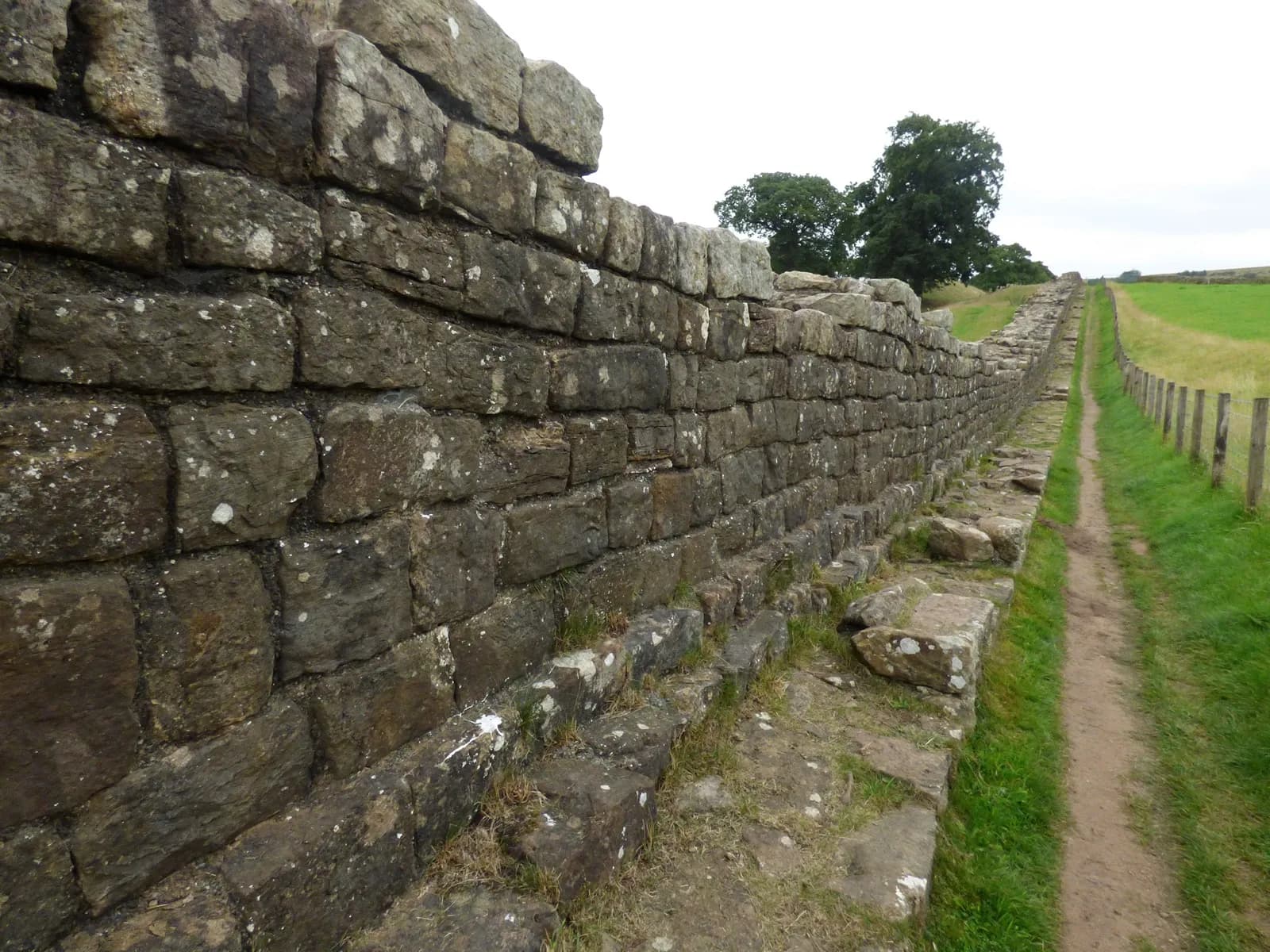
Most people's picture of Hadrian's Wall comes from Northumberland, but some of the finest surviving masonry is right here on the Cumbrian side. Outside Birdoswald fort runs the longest continuous stretch of the Wall still visible today, and this walk follows the National Trail east beside it.
You pass Harrows Scar milecastle on the lip of the Irthing gorge, cross the river on a modern footbridge beside the massive abutment of the Roman bridge at Willowford, then follow a 914 metre run of Wall with two turrets. At Gilsland, Poltross Burn is one of the best-preserved milecastles on the whole Wall, with the remains of an oven and a stair to the rampart walk.
It is short and not strenuous, though there are slopes and steps. It suits families and anyone who wants the Wall at its most tangible without committing to a long stage.
The route
- 1
Birdoswald to Harrows Scar
From the car park, walk east along the Hadrian's Wall Path beside the long stretch of Wall outside Birdoswald fort to Harrows Scar Milecastle, perched above the River Irthing.
- 2
Over the Irthing
Descend to the footbridge over the Irthing. On the far bank, the great stone abutment of the Roman bridge at Willowford stands beside the river.
- 3
Willowford Wall
Follow the National Trail east alongside the Willowford stretch of Wall, a fine 914 metre run with two turrets, past Willowford farm.
- 4
Poltross Burn and back
Continue to Poltross Burn Milecastle on the edge of Gilsland, crossing the railway with care. Explore the barrack blocks and stair, then return the same way to Birdoswald.
Questions people ask
Is Willowford Wall free to visit?
Yes. Willowford Wall, Turrets and Bridge and Poltross Burn Milecastle are both free and open at any reasonable time in daylight. Birdoswald fort itself charges for entry.
Where do you park to walk from Birdoswald to Gilsland?
Use the car park at Birdoswald Roman Fort, which is charged; English Heritage members with a valid sticker park free. Limited free parking is also available near the Samson Inn in Gilsland.
Is the walk from Birdoswald to Willowford suitable for wheelchairs?
No. English Heritage notes slopes and steps on the route, and neither Willowford nor Poltross Burn is suitable for wheelchairs.
More walks nearby
Lanercost Priory and Hadrian's Wall
Moderate, 6.7 km, 115 m up, about 1 hour 30 minutes
A gentle loop from Lanercost Priory up to the line of Hadrian's Wall at Hare Hill, west along the Wall and back beside the River Irthing.
Talkin Tarn circuit, near Brampton
Easy, 2.3 km, 7 m up, about 30 minutes
A flat, hard-surfaced loop round the tarn at Talkin Tarn Country Park, with a tearoom at the boathouse. Good for wheelchairs, buggies and dogs.
Gelt Woods and Greenwell from Low Gelt Bridge
Moderate, 9.1 km, 204 m up, about 2 hours
Field paths over Watch Hill to Greenwell, then home through the wooded gorge of the River Gelt below the old Brampton quarries.