Rannerdale Knotts and the bluebell valley
A small fell with a big view over Crummock Water, climbed via Rannerdale, the valley famous for its May carpet of bluebells.
- Distance
- 5.3 km
- 3.3 miles
- Ascent
- 356 m
- High point 350 m
- Time
- 1 hour 30 minutes
- Walking time, no stops
- Grade
- Moderate
- Circular
Take this walk with you
Google Maps does not know most fell paths, so use it to get to the start, then follow the GPX in an app like OS Maps, Komoot or AllTrails. To see the line in Google Maps, open Google My Maps, create a map, choose Import and pick the KML file. It then appears in the Google Maps app under Saved, Maps.
Weather on this walk
Loading the forecast
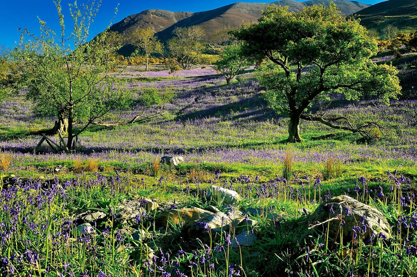
Rannerdale Knotts is barely a fell by Buttermere standards, but few summits give you as much for so little. The rocky ridge stands right above Crummock Water, and from the top you look straight down the lake with the high fells of Buttermere stacked up behind.
The approach is the real draw in spring. The quiet side valley of Rannerdale fills with bluebells in May, growing on the open fellside rather than in woodland, which makes the colour unusually vivid. Outside May it is simply a peaceful green valley with a beck and a lot of sheep.
The loop is short but includes a properly steep, rocky descent to Hause Point. Fit families and older children will enjoy it; younger ones manage the valley easily but may need help on the way down.
The route
- 1
Into Rannerdale
From the car park take the gate furthest from the lake, which leads onto a marked path into Rannerdale. The start is gentle, through the valley where the bluebells grow.
- 2
Along the beck
The path follows the beck round the back of the fell. In bluebell season, stick to the path: the National Trust has roped off areas to stop the flowers being trampled.
- 3
Up onto the ridge
Near the head of the valley, turn back on yourself and climb onto the ridge of Rannerdale Knotts. Follow it west over a series of rocky knolls towards the lake.
- 4
Summit
The top, at 355 metres, gives a fine view along Crummock Water. It is a good place to stop before the descent.
- 5
Down to Hause Point
Descend on the lake side of the fell towards Hause Point. This section is steep and rocky, so take your time. At the bottom, follow the path back to the car park.
Questions people ask
When are the Rannerdale bluebells out?
Usually mid May, though the timing shifts with the weather. Go early in the day: the valley is very busy at peak season.
How long is the Rannerdale Knotts walk?
The circuit from the car park by Crummock Water is about three and a half miles and takes around two hours.
Where do you park for Rannerdale bluebells?
A small free National Trust car park sits beside the B5289 at the foot of Rannerdale Knotts, by Crummock Water. Space is limited and it fills quickly in May, so arrive early.
Is Rannerdale Knotts suitable for children?
Yes for older children. The valley section is easy, but the descent to Hause Point is very steep.
More walks nearby
Buttermere lake circuit
Easy, 8.8 km, 122 m up, about 2 hours
A level walk all the way round Buttermere, with a lakeshore tunnel, a beach at the head of the lake and the High Stile ridge towering above.
Red Pike, High Stile and High Crag from Buttermere
Hard, 14.1 km, 839 m up, about 4 hours
One of Lakeland's great ridge walks: up past Bleaberry Tarn to Red Pike, along the crags to High Stile and High Crag, then down Gamlin End to Scarth Gap and the lake.
Loweswater and Holme Wood from Maggie's Bridge
Easy, 3.8 km, 5 m up, about 1 hour
A level, fully accessible walk along the quiet south shore of Loweswater into the oaks of Holme Wood. A Miles without Stiles route for all.