High Cup Nick from Dufton
The great U-shaped chasm of the North Pennines, reached over wild moorland from Dufton and followed home along its rim on the Pennine Way.
- Distance
- 18.4 km
- 11.4 miles
- Ascent
- 586 m
- High point 677 m
- Time
- 4 hours 30 minutes
- Walking time, no stops
- Grade
- Hard
- Circular
Take this walk with you
Google Maps does not know most fell paths, so use it to get to the start, then follow the GPX in an app like OS Maps, Komoot or AllTrails. To see the line in Google Maps, open Google My Maps, create a map, choose Import and pick the KML file. It then appears in the Google Maps app under Saved, Maps.
Weather on this walk
Loading the forecast
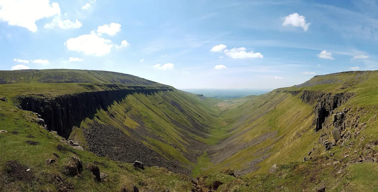
High Cup is one of the most extraordinary landforms in England: a perfect glacial trough scooped out of the Pennine escarpment, its rim lined with the dark columns of the Whin Sill. Stand at the Nick, its head, and the ground simply falls away into a great green valley running down towards the Eden.
This loop makes a full day of it. It climbs past Dufton Pike into a quiet valley of old mine workings, crosses the moor to Great Rundale Tarn and follows Maize Beck down to the Pennine Way, arriving at the Nick from above. The return is the finest part: a long walk along the northern rim with the whole trough below you, then a gentle descent to Dufton.
It is a big, remote outing on rough and often boggy ground. Fit walkers who can navigate will find it one of the best days out in Cumbria, and almost nobody else does it.
The route
- 1
Out of Dufton
From the car park head south, follow the road left, and go straight on where the lane turns right. At the track divide just outside the village keep right and climb steadily with Dufton Pike on your left.
- 2
Past Dufton Pike
Cross the col east of Dufton Pike and drop slightly into a steep-sided valley with old mine workings. Continue on the track to a shooting cabin.
- 3
Great Rundale Tarn and Maize Beck
Just beyond the cabin, reach the north shore of Great Rundale Tarn and follow it to the outflow, Maize Beck. Follow the beck downstream for about 2.5 kilometres on a rough, often wet path.
- 4
To High Cup Nick
Cross the footbridge over Maize Beck onto the Pennine Way, turn right and cross the limestone pavement to High Cup Nick.
- 5
Along the rim
Follow the Pennine Way west along the wide path on the northern rim of High Cup, with the trough below on your left, then descend gently towards Dufton.
- 6
Back to the village
On reaching the village road, turn right and follow it back to the car park.
Questions people ask
How long is the walk to High Cup Nick from Dufton?
This loop via Great Rundale Tarn and the Pennine Way is about 10.5 miles and takes around six hours. Following the Pennine Way out and back is a little shorter.
Where do you park for High Cup Nick?
There is a small car park in Dufton village, with public toilets nearby.
Is High Cup Nick hard to walk?
It is not steep for most of the way, but it is long, remote and boggy, and needs good navigation in poor weather.