Guides · 21 October 2026
The best tarns in the Lake District, and how to reach each one
By Only Cumbria, updated 21 October 2026, 6 minute read
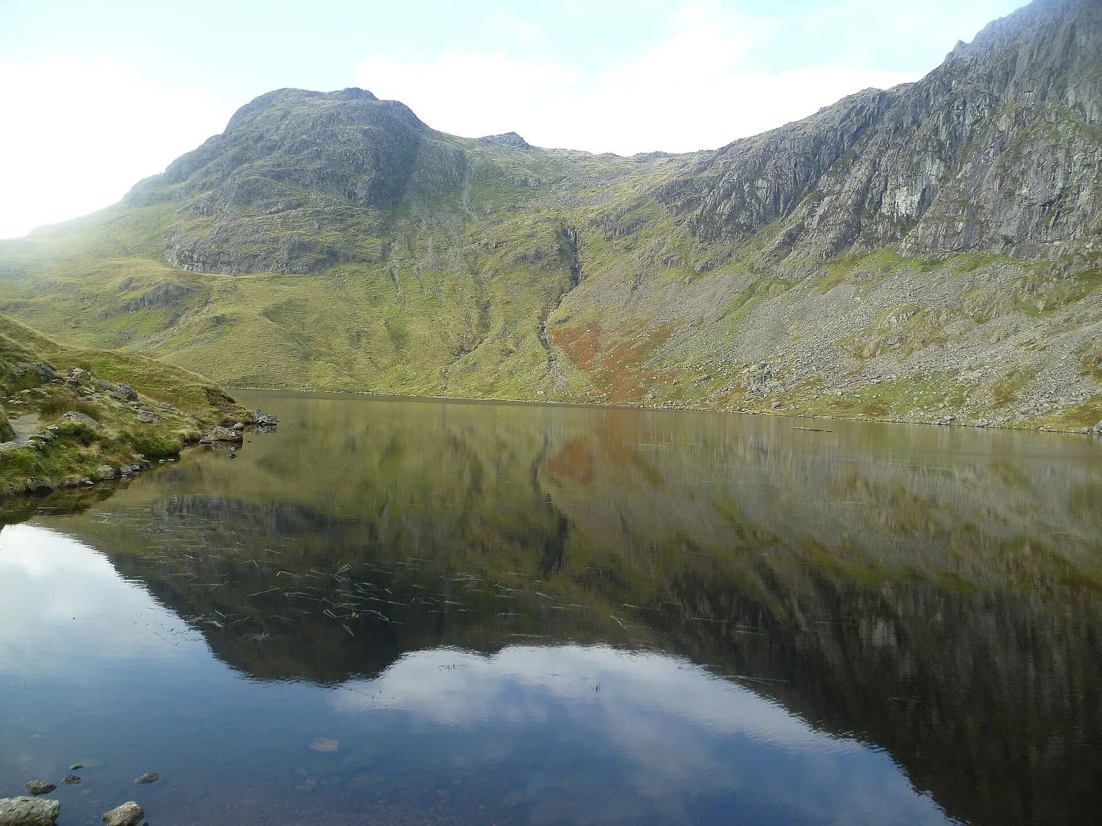
A tarn is a small mountain lake, and the Lake District has hundreds of them. Some sit beside a road and you can push a wheelchair round them. Others are tucked into a high corrie under a cliff and take a proper mountain day to reach. What they share is that they reward the walk far more than their size suggests: still water, a ring of crags, and usually far fewer people than on the shore of Windermere.
This is our pick of the best, grouped by how much effort they take, with the walk to use for each. Where we have a full route, we link to it; those pages have the directions, maps and safety notes.
Easy tarns: short walks on good paths
Tarn Hows
The most famous tarn in the Lakes is not quite natural. There were once three smaller tarns here, and in the nineteenth century James Garth Marshall dammed the lowest to make the single sheet of water you see now. In 1930 Beatrix Potter bought the whole Monk Coniston estate, which includes Tarn Hows, and the National Trust took it on in stages; it still looks after it today. It is a Site of Special Scientific Interest.
A broad, well-surfaced path runs round the water through larch and pine, with the Langdale and Coniston fells behind. Our Tarn Hows circular walk is about 3 km and suits almost anyone, though the National Park notes it is not completely step-free. It is busy on fine weekends, so go early or late in the day. See Coniston and Hawkshead for the nearest villages.
Blea Tarn, Little Langdale
Blea Tarn sits in a hanging valley between Great and Little Langdale, with one of the classic views of the Langdale Pikes across the water. Wordsworth's long poem The Excursion mentions the tarn and the farmhouse beside it. It is a protected Site of Special Scientific Interest.
The National Park's Miles without Stiles route starts from the National Trust car park on the road between the two valleys. The first section to the tarn is a good compacted stone path, but the slope from the car park is steep and the far side is rough and rocky. The nearest bus stop is the Old Dungeon Ghyll, on the 516 Langdale Rambler. See Langdale.
Talkin Tarn, near Brampton
Outside the National Park, Talkin Tarn is a natural tarn in a Cumberland Council country park, with a hard-surfaced, level path all the way round, benches, and a tearoom by the car park. It is one of the most accessible lakeside walks in the county: see our Talkin Tarn circuit.
Lanty's Tarn, Glenridding
A short climb through woodland above Glenridding brings you to a small tarn named after Lancelot Dobson, an eighteenth-century landowner, with a little dam at the far end. The walk is about 2.5 miles, and the tarn is the first tarn on our Striding Edge route, which passes it on the way up. You do not need to go any further than the tarn: the nearby knoll of Keldas has a fine view over Ullswater. See Glenridding.
Watendlath Tarn
Watendlath is a hamlet and tarn owned by the National Trust, at the end of a narrow single-track road that climbs from the Borrowdale road over Ashness Bridge. Princess Louise gave the tarn to the Trust in memory of her brother, Edward VII, and Hugh Walpole made the farmhouse at Fold Head the home of Judith Paris in his Herries novels. The road is narrow with passing places, so drive slowly and be ready to reverse. See Borrowdale.
Half-day tarns: a proper walk, no scrambling
Easedale Tarn, Grasmere
Grasmere's classic tarn walk climbs beside the white cascades of Sourmilk Gill into a side valley, where the tarn sits in a bowl under Tarn Crag and Blea Rigg. Our Easedale Tarn walk makes a loop of it, returning by Far Easedale. The path is stepped and rocky on the climb and boggy on the way back, and the stepping stones at the outflow can be impassable after heavy rain.
Alcock Tarn, Grasmere
Short and sharp: a steep climb beside Greenhead Gill from Grasmere to a reedy tarn on a shelf of open fell, then a descent towards Dove Cottage with the whole vale in front of you. See our Alcock Tarn walk, and the Grasmere page for parking and food.
Stickle Tarn, Great Langdale
The tarn in the lap of the Langdale Pikes, under the great face of Pavey Ark. A stone dam built in 1838 enlarged it, and it still supplies water to Langdale. The path climbs steeply beside Stickle Ghyll from the New Dungeon Ghyll; walkers use the National Trust's Stickle Ghyll car park beside it, not the hotel's. Our Stickle Tarn walk is short but steep, with slippery stone steps in the wet. Jack's Rake, the diagonal line up Pavey Ark, is a serious scramble and not part of this walk.
Levers Water, Coniston
At the head of the Coppermines Valley above Coniston, Levers Water was enlarged by a dam in 1717 to supply the copper mines. The usual approach is up through the old mine workings from the village rather than off the Old Man tourist path. Its neighbour Low Water, in a corrie under the summit of the Old Man, is on our Old Man of Coniston walk. Never enter mine levels or go near shafts.
Mountain tarns: for experienced walkers
Innominate and Blackbeck Tarns, Haystacks
"Innominate" means without a name. The tarn, once known as Loaf Tarn, lies at about 520 metres near the summit of Haystacks above Buttermere, and Alfred Wainwright asked for his ashes to be scattered here. Blackbeck Tarn is a short way on. Our Haystacks walk from Gatesgarth passes both. The summit plateau is a confusing maze of knolls and pools in mist. Older guides put Innominate in Borrowdale; it is on the Buttermere side.
Goat's Water, Coniston
A wild hollow between Dow Crag and the Old Man of Coniston. Our Old Man of Coniston walk descends to it from the summit and returns along the Walna Scar Road; you can also walk up to it from the end of the Walna Scar Road and back.
Angle Tarn, Langdale
This Angle Tarn sits in a corrie beneath Hanging Knotts, the north-east corner of Bowfell, below Ore Gap. The standard approach is from the Old Dungeon Ghyll, along the flat floor of Mickleden and up the steep climb of Rossett Gill; you can also reach it from Stonethwaite in Borrowdale up Langstrath, a long walk. It is a full mountain day either way. Older guides offered a quick approach from the Wrynose Pass. There is not one.
Red Tarn, Helvellyn
Red Tarn lies at 718 metres in the corrie on Helvellyn's eastern side, cupped between Striding Edge and Swirral Edge. It is about 25 metres deep, and in the nineteenth century its level was raised with a dam to power the Greenside Mine at Glenridding. It is also one of the few homes of the schelly, a rare freshwater fish. Our Striding Edge route descends to it from Swirral Edge; if the scrambles are not for you, you can walk up to the tarn from Glenridding and turn back there.
Scales Tarn, Blencathra
The dark bowl at the foot of Sharp Edge, reached up Scales Beck from the A66. The tarn itself is the turning point for anyone not committing to the ridge. Our Blencathra via Sharp Edge page explains the alternatives: Sharp Edge is a serious, exposed scramble and dangerous in the wet.
Before you go
- Parking: the road-end car parks for Langdale, Tarn Hows, Haystacks and Glenridding fill early on fine weekends. See our parking guide, and for bus-friendly starts, the car-free guide.
- Weather: the higher tarns are in serious mountain country. Take a map and compass, warm layers and waterproofs, and turn back if the cloud comes down.
- Swimming: if you are tempted, read our wild swimming guide first. Mountain tarns are cold, deep and far from help.
- Dogs: most of these routes cross grazing land, so keep dogs on a lead. Our dog-friendly guide has more.
- Rain: Easedale and Stickle are at their best after rain, when the becks are running, but the stepping stones and ghyll paths are at their most slippery.