Guides · 21 October 2026
Helvellyn via Striding Edge: the complete guide to the classic scramble
By Only Cumbria, updated 21 October 2026, 7 minute read
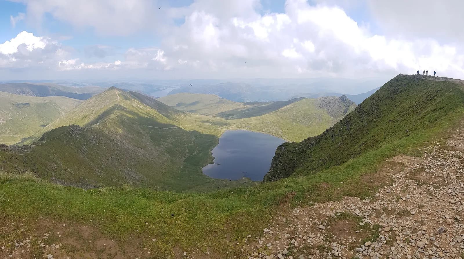
Striding Edge is the most famous ridge in England, and for good reason. A long crest of rock runs out from Birkhouse Moor towards Helvellyn, with Red Tarn far below on one side and Nethermost Cove on the other, and on a clear day it feels like walking along the spine of the Lake District. This guide is the companion to our route page for Helvellyn via Striding Edge, which has the map and step-by-step directions. Here we go deeper: what the edge is actually like underfoot, where the hard moves are, how winter changes everything, and how to get down safely.
Helvellyn and the edge in numbers
- Helvellyn: 950 metres, the third-highest point in England and in the Lake District, according to Wikipedia. The Ordnance Survey trig point to the north is a metre lower.
- Striding Edge: a little over 1.5 km, about a mile, from the Hole-in-the-Wall to the summit plateau. Its highest point, High Spying How, is 863 metres.
- Grade: the British Mountaineering Council (BMC) calls it a Grade 1 scramble, at the easier end of that grade. That is a technical grade for dry rock in calm weather, not a measure of how serious a fall would be.
- The round: Mud and Routes logs the Glenridding horseshoe, over Striding Edge and back down Swirral Edge, at about 13 km. Most people take six or seven hours with stops.
- Map: Ordnance Survey Explorer OL5, The English Lakes North-eastern area.
The rock
Older guides sometimes describe Striding Edge as granite. It is not. Like most of the central fells, Helvellyn is built from the Borrowdale Volcanic Group, rocks laid down around 450 million years ago in the Ordovician period inside the caldera of an ancient volcano. The crest of Striding Edge and the summit are capped by a volcanic sandstone, the Deepdale Sandstone Formation. Ice age glaciers then scooped out the coves on the eastern side and left the sharp arêtes between them. The rock is rough and grippy when dry, polished in places, and greasy after rain.
Along the edge, section by section
The approach and the Hole-in-the-Wall
From Glenridding or Patterdale the paths climb Birkhouse Moor to the Hole-in-the-Wall. The name dates from when a gate was missing here; the gap has long since been filled and you now cross the wall by a ladder stile. This is the moment you see the whole of Striding Edge laid out ahead, and it is the last easy place to change your mind. If the wind is already making you stagger at the wall, it will be worse on the crest.
The crest
The ridge narrows quickly. You can stay right on the top, which is the best of it, or follow worn paths a little below the crest for much of the way. The BMC notes that a path on the Red Tarn side bypasses the main difficulties, though you cannot avoid scrambling altogether. Partway along, on the left as you head for the summit, a small memorial records Robert Dixon of Patterdale, who was killed here in 1858 while following foxhounds. It is easy to miss.
The Bad Step
The trickiest move comes near the far end. The crest finishes in a short rock tower, roughly seven metres high by the BMC's estimate, and you have to climb down a chimney on its far side to regain the path. Walkers call it the Bad Step. The holds are good, but you are facing in, looking for footholds below you, with a big drop to one side. The BMC suggests letting a more experienced companion go first so they can guide your feet, and testing every hold. Mountain rescue reports from the edge mention it often enough that it deserves your full attention.
The final climb to the plateau
After the Bad Step a short level section leads to the headwall, a steep climb of about 80 metres over rough rock and loose scree. W. A. Poucher called it the Abyss in his mid-century guidebooks. The BMC's advice is to take the line up the middle of the rock rather than the scree on the left, which is the common mistake and the more unpleasant ground. On the way up you pass the Gough memorial. Charles Gough fell from the edge in April 1805, and his remains were found three months later with his dog still beside him; Wordsworth wrote about it in his poem "Fidelity", and the stone, put up in 1890, quotes it.
The summit
From the top of the headwall the summit is about 200 metres away across the plateau. The large stone summit shelter there was built in the 1950s and restored by volunteers and rangers in 2014. A little south of it, a stone tablet marks the day in December 1926 when Bert Hinkler and John Leeming landed a small aeroplane on the plateau and took off again.
Getting down
The descent is where tired walkers make mistakes. Pick your route before you leave the summit, and in mist take a bearing.
- Swirral Edge to Red Tarn. The classic finish. The top of Swirral Edge is just north of the summit and marked by a cairn; the edge is shorter and less exposed than Striding Edge but still steep, rocky and slippery when wet. From its foot you can drop to Red Tarn and follow the path back to the Hole-in-the-Wall, or carry on to the neat pyramid of Catstye Cam (890 metres) first.
- The walkers' path north. If you have had enough scrambling, the BMC points to the hill path heading north off Helvellyn towards Lower Man and White Side, then down the old pony track past the Greenside mines into Glenridding. It is longer but has no scrambling. This is the line of our Helvellyn by the Pony Path route.
- Not Thirlmere. Paths also drop west to Thirlspot, Swirls and Wythburn on the A591. They are good routes in their own right, but they put you in the wrong valley, many miles by road from a car in Glenridding.
Winter on Helvellyn
From late autumn to spring Helvellyn is a different mountain. Snow and ice turn both edges and the headwall into winter mountaineering ground, and cornices build over the eastern cliffs above Red Tarn, so keep well back from the edge of the plateau. You need an ice axe and crampons, and the skills to use them; a winter skills course is a sensible first step.
The Lake District National Park Authority employs fell top assessors who climb Helvellyn every day through the winter. Each report records temperature, maximum and average wind speed, wind chill, wind direction and conditions underfoot, with photographs, and is published on the Weatherline service. The National Park says the assessors will be back from December 2026 until spring 2027. Read the latest report before any winter attempt.
Wind is the other big risk in any season. The BMC's main warning about Striding Edge is to avoid it in windy weather, because exposure is the real challenge. Check the Mountain Weather Information Service (MWIS) Lake District forecast, which gives summit wind speeds, the chance of cloud-free tops and the freezing level, alongside the Met Office mountain forecast linked from Weatherline.
When it goes wrong
Patterdale Mountain Rescue Team, made up of volunteers, is the team called to the Glenridding side of Helvellyn, and Striding Edge features regularly in its callouts. A typical example, reported by grough in December 2024, was a solo walker stranded on a wintry Striding Edge after dark with no torch; volunteers met him near the Hole-in-the-Wall and walked him down. Carry a head torch, start early in short days, and if you get into trouble call 999, ask for the police and then mountain rescue.
Parking and getting there
Most people start from the National Park car park at Glenridding, beside the beck in the village; it is pay and display, so check the current tariff on our Glenridding car park page. It fills early on fine summer weekends. Patterdale, a little further south along the valley, is the alternative start; paths from both villages climb to the Hole-in-the-Wall. Without a car, Stagecoach buses run along Ullswater to Glenridding (check current timetables) and Ullswater Steamers call at Glenridding pier, which makes a lovely way to arrive from Pooley Bridge. See our Glenridding and Ullswater pages, and car-free travel.
Afterwards, the Ramblers Bar at the Inn on the Lake in Glenridding is a handy spot, and dogs are allowed in the bar. If you are making a weekend of it, our Ullswater long weekend has more ideas, and Wainwrights' greatest hits covers the other classic fells.
Before you go
- Check MWIS and Weatherline the evening before and on the morning. Strong wind is a reason to choose another day or the Pony Path.
- Be honest about heights. If narrow, exposed ground worries you, try a smaller ridge first, or keep to the paths below the crest.
- Leave the dog at home. Both edges involve scrambling that is dangerous for dogs.
- Carry OS OL5, a compass and a head torch, plus waterproofs, warm layers, hat and gloves even in summer.
- Winter: ice axe, crampons, the skills to use them, and the latest fell top assessor report.
- Tell someone your route and when you expect to be back.