Guides · 21 October 2026
Scafell Pike: how to climb England's highest mountain
By Only Cumbria, updated 21 October 2026, 7 minute read
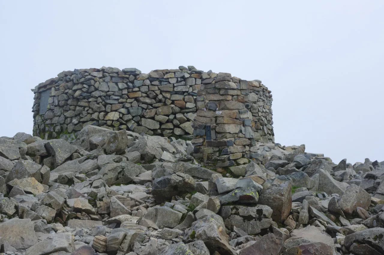
At 978 metres, Scafell Pike is the highest ground in England, and it is a proper mountain rather than a big hill. The summit is a dome of shattered rock, the weather up there is often several notches worse than in the valley, and every year people who set off in trainers on a sunny morning end up needing help. Done well, though, it is one of the great Lakeland days, and each of the three classic approaches has a completely different character.
This guide covers the routes from Wasdale, Borrowdale and Great Langdale, where to park, how to stay on track, and what the slate plaque in the summit cairn is about.
The three main routes
The distances below are approximate one-way figures from Anywhere We Roam's route guide; double them for the round trip and allow for stops.
Wasdale Head via Brown Tongue: the shortest
- Start: National Trust Lake Head car park at the head of Wastwater
- One way: about 4.2 km with roughly 915 metres of ascent
- Round trip: most people take five to six hours
This is the quickest way up, and the one most Three Peaks groups use. It follows Lingmell Gill, climbs the long stone staircase of Brown Tongue into the rough hollow of Hollow Stones, then swings up to Lingmell Col and over the boulders to the top. There is no scrambling, but it is relentlessly steep and very hard on the knees coming down. Our full route description, with a map, is at Scafell Pike from Wasdale Head.
Short does not mean easy. Mud and Routes, who log a slightly longer version of this walk that also takes in Scafell, grade it hard and put the ascent at over 1,100 metres.
Seathwaite and the Corridor Route: the finest
- Start: Seathwaite, at the head of Borrowdale
- One way: about 7.5 km with roughly 945 metres of ascent
- Round trip: a long day; allow seven hours or more
From Seathwaite the path crosses the beck at Stockley Bridge and climbs to Styhead Tarn, under Great Gable. From there the Corridor Route traverses the flank of the Scafell range, past the deep cleft of Piers Gill, to reach the summit from the north. Many walkers return the other way, via Esk Hause and Grains Gill, to make a loop. This is the most varied and scenic of the three, with one short rocky step on the Corridor Route that needs care. Parking in Borrowdale is tight; see the Seatoller notes below.
Great Langdale via Rossett Gill and Esk Hause: the longest
- Start: Old Dungeon Ghyll, at the head of Great Langdale
- One way: about 9.3 km with roughly 1,030 metres of ascent
- Round trip: a full mountain day, often eight hours or more
This route walks the flat floor of Mickleden, climbs Rossett Gill to Angle Tarn, then crosses Esk Hause and the rough ground over Broad Crag col to the summit. It is long and committing, but it suits strong walkers who want to feel they have crossed the heart of the fells rather than nipped up from the nearest road. Bow Fell and Esk Pike can be added on the way back for a very big day.
There are other lines, including Little Narrowcove from Eskdale and Moses' Trod from Wasdale Head, but they are best left until you know the mountain.
How hard is it, honestly?
For a fit walker used to hills, Scafell Pike in good summer weather is a demanding but straightforward day. The difficulty lies in three things:
- Ascent. Whichever way you go, you climb around 900 to 1,000 metres. That is a lot of steps, up and down.
- Terrain. The top section is a boulder field. It is slow, ankle-twisting ground, and slippery when wet.
- Navigation. The summit plateau is broad, rocky and featureless, and paths leave it in several directions. In mist it is genuinely easy to walk off the wrong way and end up in the wrong valley, many miles from your car.
Carry a map (Ordnance Survey Explorer OL6 covers the south-western fells) and a compass, and know how to take a bearing off the summit back to your route. A phone app is useful, but batteries die fast in the cold. Take waterproofs, warm layers, a hat and gloves even in July, plus more food and water than you think you need.
When to go
Late spring to early autumn gives the longest days and the best chance of clear views. In winter the upper slopes can hold snow and ice for weeks, and the mountain becomes a serious undertaking that needs an ice axe, crampons and the skills to use them.
Whatever the season, check a mountain forecast rather than the town one. The Mountain Weather Information Service (MWIS) and the Met Office mountain forecast both cover the Lake District fells, and give summit wind speeds, wind chill and the chance of the tops being in cloud. If the forecast says gusts strong enough to make walking difficult, pick a valley walk instead.
Midweek outside school holidays is far quieter. On summer weekends the Wasdale route can feel like a procession.
Parking and getting there
Wasdale. The main car park is the National Trust's Lake Head car park at Wasdale Head (postcode CA20 1EX), at the top of Wastwater beside the campsite. It is pay and display with around 100 spaces and public toilets next to it. National Trust members park free; check the National Trust's Wasdale car parks page for the current tariff. Mobile signal in Wasdale is very poor, so do not rely on paying by app, and bring coins as a backup. More detail is on our Lake Head car park page, and our Wasdale guide covers the valley.
Wasdale is a long drive from almost everywhere, and there is no realistic bus service, so build that into your day.
Borrowdale. Space at Seathwaite itself is limited and fills very early. The National Trust car park at Seatoller is the nearest formal option, and Borrowdale buses from Keswick stop there; check current timetables. See Borrowdale.
Great Langdale. The National Trust's Stickle Ghyll car park sits by the New Dungeon Ghyll, a short walk down the valley from the Old Dungeon Ghyll. See Langdale and our parking guide.
The summit memorial
The summit has a large stone cairn with a trig point, and set into the cairn is a slate tablet that most people walk straight past. It records that the summit was given to the nation and placed in the custody of the National Trust in 1919 by Charles Henry, Baron Leconfield, in perpetual memory of the men of the Lake District who died in the First World War. The War Memorials Register notes that the Trust took over its care in 1920 and that the memorial was unveiled on 24 August 1921.
In 2018 National Trust rangers camped on the summit to rebuild the cairn and reset the plaque within its walls. If you reach the top on a clear day, it is worth pausing at the plaque before you start the descent.
Three Peaks etiquette
Scafell Pike is the middle mountain of the National Three Peaks Challenge, and many teams arrive in Wasdale in the middle of the night. Wasdale Head is a tiny farming community with a campsite right next to the car park. The Wasdale Three Peaks guidelines, published with Fix the Fells, ask visitors to:
- Park only at Lake Head, never in passing places, gateways, verges or on the village green. Coaches cannot get to Wasdale Head.
- Avoid noise between 11pm and 7am: keep voices down and switch off engines and headlights.
- Use toilets before you arrive, as facilities in the valley are limited, and take all litter home.
- On night ascents from Lake Head, use the permissive path on the north side of Lingmell Gill to avoid disturbing the Brackenclose climbing hut and residents.
- Keep to the paths rather than the grass at their edges, and stagger start times to avoid queues.
The fundraising code of conduct for charity organisers asks events to limit numbers, avoid weekends and bank holidays where possible, and arrange their own experienced marshals rather than relying on the volunteer mountain rescue team. The guidelines also suggest something we would endorse: do the challenge over three days rather than 24 hours, and actually see the valley.
After the walk
In Wasdale, the Wasdale Head Inn, which calls itself the birthplace of British climbing, has Ritson's Bar for a pint at the end of the day. In Borrowdale, the Langstrath at Stonethwaite has a bar and restaurant open to non-residents (closed Mondays). In Great Langdale, the Climbers Bar at the Old Dungeon Ghyll has fed walkers for generations.
Before you go
- Check MWIS or the Met Office mountain forecast the evening before and the morning of your walk.
- Start early, especially from Borrowdale or Langdale; you want daylight in hand for the descent.
- Carry a map and compass and know the bearing from the summit back to your route.
- Tell someone your route and when you expect to be down.
- In an emergency, call 999 and ask for the police, then mountain rescue.